Tag Maps
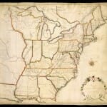
40-year map project, History of Cartography, draws to a close
The series brings together cutting-edge research and a colorful collection of stories and histories told through maps. It has drawn international attention to the history of maps and mapping.
UW–Madison researchers tracking travel, social media to help contain virus
New data shows that Wisconsinites traveled more during Tuesday’s election than they did on the days leading up to the statewide vote, according to University of Wisconsin–Madison researchers who are tracking the mobility of Americans increasingly urged to stay still.
View from on high: UW–Madison houses Wisconsin aerial photos
Geography Department's many aerial photos vividly show Wisconsin's changing landscape since 1937.
Forecasting antibiotic resistance with a ‘weather map’ of local data
To help physicians choose the best antibiotic first, researchers in the School of Pharmacy and the State Cartographer's Office are drawing inspiration from the weather.
Mapping cropland: UW–Madison plays critical role in worldwide map
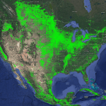
A UW–Madison researcher was part of a global collaboration has just released a satellite-based map of world croplands that “found” 625 million to 875 million acres that were not known to national agricultural authorities.
State cartographer’s office releases third edition of statewide parcel map
The state cartographer’s office at UW–Madison has released the latest update to a portal that pulls together 72 county databases that document who owns which parcels of land in Wisconsin.
UW–Madison map library pinpoints Sawyer County site of 1966 bomber crash
Staff at the Arthur H. Robinson Map Library at the University of Wisconsin–Madison used their resources to help track down the site where a 130-ton B-52 bomber crashed in the dark on Nov. 18, 1966, near unincorporated Hauer in Sawyer County in northwestern Wisconsin.

