
High-schooler teams with UW researchers to help Madison improve bike parking
It wasn’t a bad gig for Kira McCoy. The high school student from Denver spent two weeks in July bicycling the length and breadth of Madison, getting plenty of sun and exercise and a good look at a community where she may attend college. But those were the perks, not the mission.
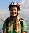
McCoy
Her job was to collect data about bike racks — a small, but important part of the city’s impressive bicycling infrastructure — and to help UW–Madison researchers demonstrate how geographic information systems (GIS) can be deployed in efforts to build a healthier urban environment.
McCoy used her bike and a handheld GPS device to build an electronic inventory of bike parking facilities on city property throughout town — in parks, at city buildings, along State Street and around the Capitol Concourse. With guidance from Art Ross, Madison’s bicycle-pedestrian coordinator, she located and photographed bike racks, logged GPS coordinates and noted their condition. She also recorded unmet needs for bike parking — spots with many bikes locked to trees and signposts.
Her efforts provided Ross with some much-needed information. The city requires private-sector developers to include bicycle parking with new construction, with specifications for capacity, design and location, but Ross wasn’t sure whether the city’s own racks met the same standards. In fact, he wasn’t all that sure where all of the racks were, because there was no comprehensive record of what had been installed over the years.
McCoy’s inventory tells him that and serves as a planning tool.
“It’s helping us develop a budget to ensure that all of our racks meet the requirements and that we have enough bicycle parking at all of the city locations, and helping us decide how to prioritize when we’re replacing or updating bike racks or adding racks where they don’t exist,” Ross says.
Everything McCoy collected went into a GIS database developed with the aid of Jeff Sledge, an outreach specialist in the university’s Land Information and Computer Graphics Facility.
“We gave her a framework to work with. She came back in, we downloaded all of her GPS data, downloaded all of her digital photography, and she stitched it together into a GIS,” Sledge explains. “She made the links between the photographs and the spatial locations and her descriptions.”
McCoy took on the project because she had a keen interest in GIS and environmental science and wanted to get a little hands-on research experience. Sledge signed on because bicycles and GIS are cornerstones of his research. Over the past several years, he has developed a protocol for using bicycles equipped to collect data on riders’ energy expenditures, which he combines with GIS data on terrain to calculate the workout value of any bike route. Along with researchers in the School of Medicine and Public Health, he is adapting the technology as a tool for combating childhood obesity and associated problems.
While McCoy’s project was a much simpler use of GIS technology, Sledge sees it as an excellent example of how skills and knowledge gained in basic research can be put into service in other useful endeavors.
“It was a really good use of technology that we had worked with over a period of years. Three or four years ago, this was all new to us then,” Sledge says. “We were struggling on how do you use this all this stuff, how do you weave it all together. It’s all matured to the point where it’s a very useful accessible tool.
“That’s what our job is — translating these new uses and new discoveries to the point where they become very accessible to people.”
Tags: business, student life, technology
-
Interwoven
How Indigenous knowledge and science can work together to communicate about climate.
-
UW–Madison’s reach throughout Wisconsin adds up to $38.9 billion a year
The university supports more than 287,000 jobs and helps drive private-sector growth.
-
‘Being part of something bigger than you’ with Badger Volunteers
UW–Madison students head into the local community to find purpose and make a difference.
-
UW–Madison’s Tech Exploration Lab: Where the classroom meets the real world
The lab is built around a simple expectation: Students come to build, test and refine projects with real problems in mind.


