Facility gives geology department new dimension
A geoscience visualization lab that opened last week in Weeks Hall will add a new dimension to geology research and education at UW–Madison.
Earth scientists constantly struggle to present and analyze information about a three-dimensional world with two-dimensional tools, such as maps, pictures, and diagrams, says geology professor Harold Tobin, who spearheaded the effort to bring the new center to campus. "Geologists have to train themselves to see in three dimensions things that are difficult to see when rendered in two dimensions," he says.
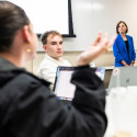
The new facility, the Halliburton Geoscience Visualization Center, should help UW–Madison scientists do exactly that. The highlight of the center is a stereographic projection system, capable of displaying images in 3-D. Slip on a pair of the special polarized glasses and features leap off the screen, revealing the shape of an earthquake fault or the pattern of ancient worm burrows snaking through a rock sample.
The facility also boasts cutting-edge multi-dimensional analysis software, video conferencing capability, and several workstations where groups of researchers can work together with large datasets.
"The really exciting thing from an educational perspective is that we can bring students in and teach them how to think in 3-D. That’s hard to do with slides and a chalkboard," says geology and geophysics department chair Jean Bahr. For example, students might learn how to read topographical maps by first seeing them superimposed on a landscape of peaks and valleys.
"Earth science is now a high-tech field," Tobin says. "This center is a great advantage for the research and teaching missions of the department."
The facility was largely built with contributions from Landmark Graphics, a subsidiary of the Halliburton Corporation. UW–Madison alumnus and Halliburton CEO David Lesar (BS ’75, MBA ’78) helped arrange the donation of the visualization software, equipment, and facility design.
The new lab provides a rare opportunity for a university to employ state-of-the-art data analysis and imaging tools developed by the energy industry. In fact, says Landmark’s director of global operations Gene Minnich, "You have far better facilities here than many companies in the industry."
The resources were provided as a gift to the university with no mandated research program, Tobin says. "They were willing to make this generous donation to the university with no strings attached."
"As a corporation, we want to connect with universities, invest in the next generation of geoscientists and unlock new ways of thinking about problems," Minnich says. "This was a natural place to do that."
UW-Madison researchers are already using the system to analyze the subsurface structure of the Pacific seafloor and to localize past earthquakes on fault lines around Sumatra. The department also expects the facility will be useful for applications outside the geosciences that involve modeling three-dimensional structures, such as crystallography and molecular modeling of chemical or protein structures.
In any field, working with data in 3-D will allow researchers and students to see and understand complex spatial relationships more clearly, Tobin says. "It opens up a whole new world."


