
Photo gallery A new view of the winter blues
Does Madison’s relentless stint of cold and snowy weather have you feeling cooped up and experiencing the winter blues? Try a fresh perspective on our winter wonderland and enjoy these recent aerial views of the UW–Madison campus. The photographs were made by Jeff Miller, senior photographer in University Communications, from the open window of a small chartered airplane during the “blue hour” of dusk on Feb. 13, 2019.
Photos and text by Jeff Miller
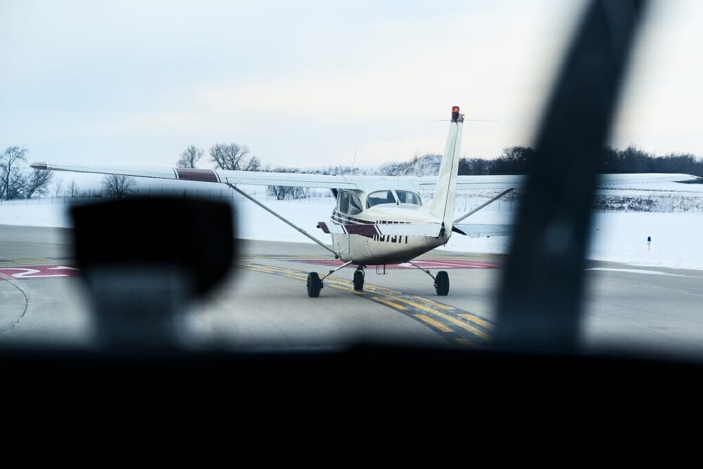
On the runway in a chartered Cessna 172 prop-wing, waiting for another small plane to take off. Photo by: Jeff Miller
Approaching the UW–Madison campus and flying west at an altitude of approximately 1,000 feet. Photo by: Jeff Miller

Picnic Point, part of UW–Madison's Lakeshore Nature Preserve, juts out into now-frozen and snow-covered Lake Mendota. From left to right are the Wisconsin Institutes for Medical Research, Waisman Center, the west campus playing fields, and Eagle Heights housing area. Photo by: Jeff Miller
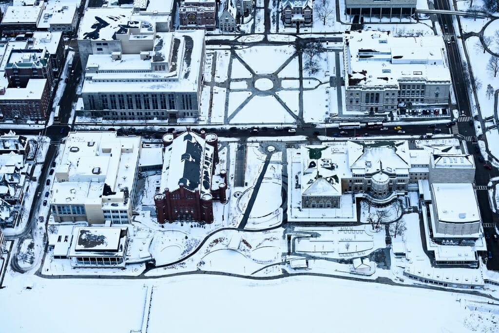
Clockwise from upper left are Memorial Library, Library Mall, Wisconsin Historical Society, Memorial Union, Alumni Park, the Red Gym (Armory and Gymnasium), One Alumni Place and the Pyle Center. Photo by: Jeff Miller
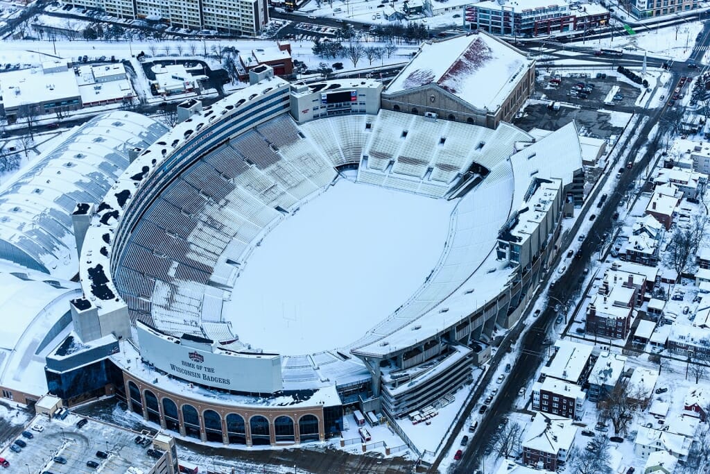
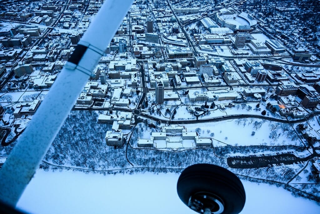
Home of the Wisconsin Badgers, a snow-covered Camp Randall Stadium appears to have more than 80,000 open seats. Photo by: Jeff Miller
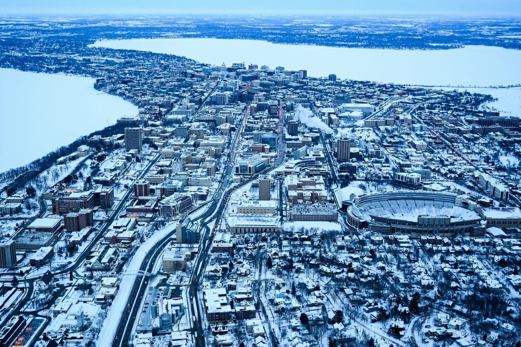
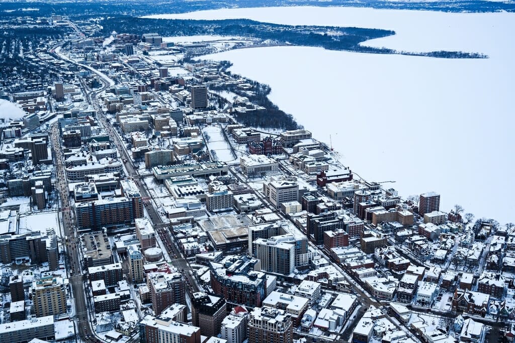
Seen looking from west to east, evening traffic starts to fill streets leading through the UW–Madison campus toward downtown Madison. The city's isthmus is flanked by frozen and snow-covered lakes Mendota, at left, and Monona. Photo by: Jeff Miller
Seen from the confined view of a Cessna prop-wing airplane looking south is the central portion of the UW–Madison campus and intersection of Observatory Drive (left to right) and Charter Street (up and down). Toward the bottom, running from left to right along the Temin Lakeshore Path, are Muir Woods, Sewell Social Sciences, Waters Residence Hall and Observatory Hill. Photo by: Jeff Miller
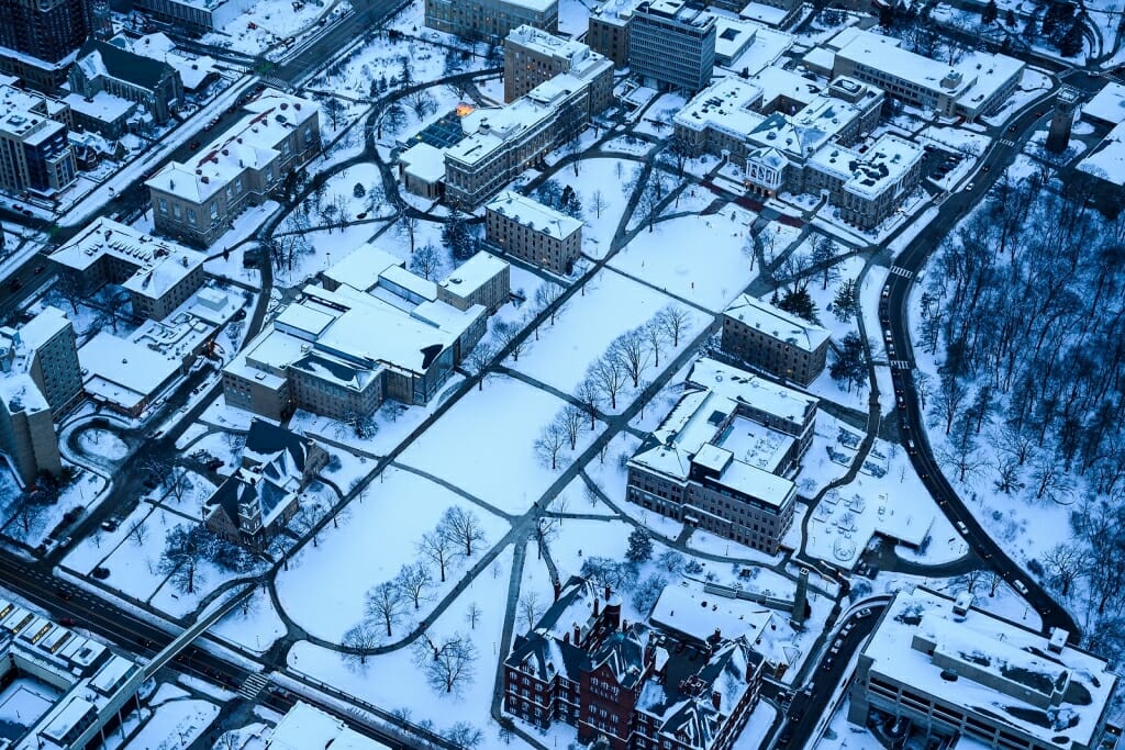
The blue light of dusk reflects off the snow-covered historic area of Bascom Hill. Clockwise from upper right are Bascom Hall, North Hall, Education Building, Helen C. White Hall, Science Hall, Music Hall, Law Building, South Hall, Birge Hall and Van Vleck Hall. Photo by: Jeff Miller
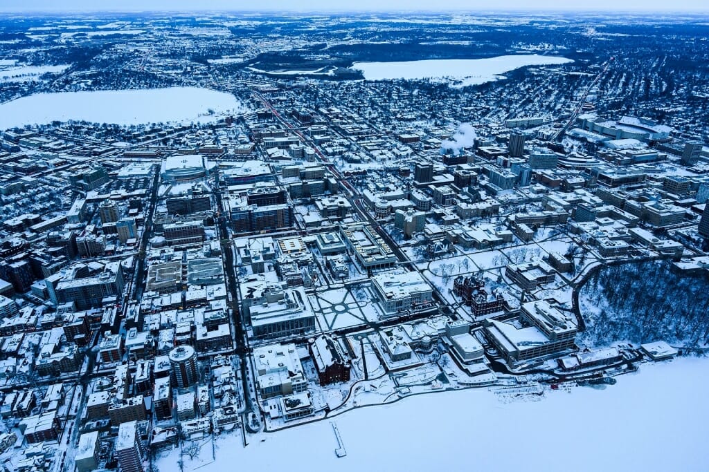
The eastern portion of the UW–Madison campus looking south from above Lake Mendota. South and North Park Street runs top to bottom through the middle of the frame, flanked by Monona Bay, at upper left, and Lake Wingra, upper right. Photo by: Jeff Miller
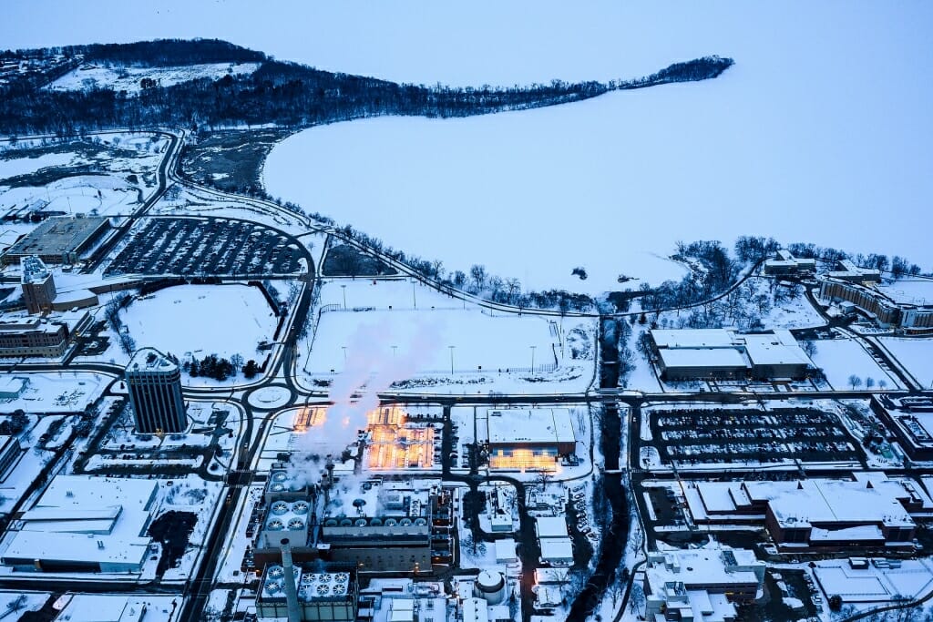
The illuminated Walnut Street Greenhouse and Biotron Laboratory look afire in this dusk-hour view of the western portion of the UW–Madison campus. Seen in a view looking north and clockwise from top are notable locations including Picnic Point, Lake Mendota, Dejope Residence Hall, Gymnasium-Natatorium, Veterinary Medicine, Wisconsin Veterinary Diagnostic Laboratory, West Campus Cogeneration Facility and WARF Office Building. Photo by: Jeff Miller
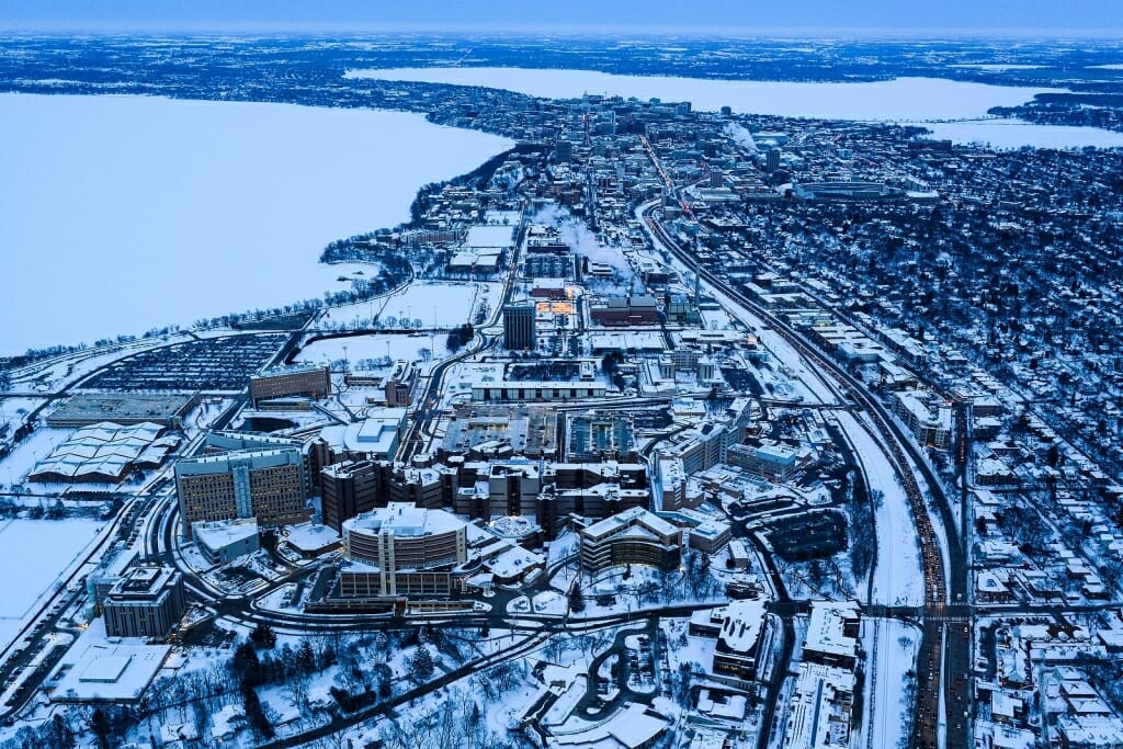
At bottom, the UW–Madison medical campus, including UW Hospital and Clinics, anchors a view looking east toward the downtown Madison isthmus. Flanking the city are lakes Mendota, at left, and Monona, at top right. Photo by: Jeff Miller
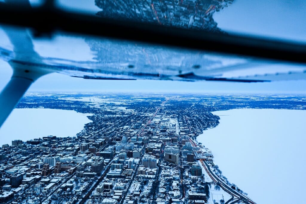
Flanked by lakes Mendota, left, and Monona, the downtown Madison isthmus is mirrored in the open window and prop-wing of the Cessna. The view is looking east. Photo by: Jeff Miller
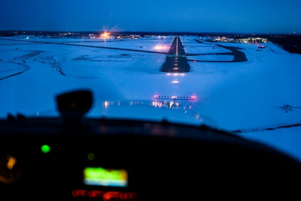
With a quick and chilly photo mission complete, the photographer's charter plane approaches a Dane County Regional Airport runway for a return landing about 20 minutes after dusk. Photo by: Jeff Miller