Cultural landscape presentation examines campus preservation
The hills, woods and wetlands of the UW–Madison landscape have an ancient history of human occupation. Twelve thousand years before anyone suggested a “college on the hill,” Native Americans called the campus area their home. More recently, Euroamericans came to the shores of Lake Mendota.
Each community has left a landscape legacy.
 Indian effigy mounds, monuments recalling the Civil War training ground at Camp Randall, designed landscape spaces such as Henry Mall and Union Terrace, and teaching gardens and research fields are but a few ways that people have given cultural expression to the 900-acre university campus landscape.
On Wednesday, Nov. 10, researchers conducting an inventory of these special campus sites will present their preliminary findings at a public presentation, “UW-Madison’s Cultural Landscape: Preserving Historic and Natural Sites on Campus.”
“The UW–Madison campus is truly a unique place — nowhere else in the world can one find so many Indian effigy mounds and archaeological sites on a university campus. This is an incredible cultural stewardship responsibility,” says Daniel Einstein, a project coordinator from the Facilities Planning and Management division.
Recently, the campus landscape has been influenced by the work of “landscape gardener” O.C. Simonds and the design plans developed by renowned architects Warren P. Laird and Paul P. Cret.
“Many of the campus designs first outlined in Laird and Cret’s General Plan of 1908 can still be seen on campus today,” says Arnold Alanen, a professor in UW–Madison’s landscape architecture department and the lead historian supervising a team of student researchers for the effort. “Henry Mall, with its central open space and flanking buildings, is a lovely example of the City Beautiful movement’s design influence. This is a tremendous teaching and research asset for our students.”
Alanen and landscape architect consultant Brenda Williams of Quinn Evans Architects will present historic photos, design plans and archaeological survey results compiled by the project. Many of these images will be available on a new university library Web site.

“The research provided by this group has already proved valuable for our current campus master planning process,” he says. “I look forward to seeing the analysis and recommendations for preservation and maintenance of these cultural assets. These places are essential to the character of our campus.”
Funding for the two-year effort was provided by the Campus Heritage Program of the Los Angeles-based J. Paul Getty Trust.
The UW–Madison main campus and Arboretum include 24 properties listed on the National Register of Historic Places (including three national landmarks). The Wisconsin Historical Society lists 33 Native American archaeological sites containing mounds and evidence of habitation on campus, including the Arboretum. The plaza in front of Bascom Hall also is the site of the city’s first Euroamerican burial.
The public seminar will be held 6:30- 8 p.m., Room 235 at the Pyle Center.

Above: This map of the campus was drawn in conjunction with a 1908 depiction of future development by Warren P. Laird, Paul P. Cret and Arthur Peabody. It is included in a bound collection, “Historical Maps Relating to Campus Development.” Its collection’s title page reveals that the plan was intended to cover the years 1850-1954. Photo courtesy UW–Madison Archives
Tags: learning
-
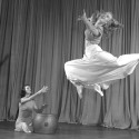
Dancing for (over) a century
The Dance Department is preparing to celebrate the centennial of UW–Madison's (and the nation's) first dance major. Look back at some of the milestones that have shaped the program.
-
The Badger starter pack
From chamber music to the chemistry lab, these five UW intro courses see the highest enrollment — and set students up for long-term success.
-
How to win a Nobel Prize
Meet the UW–Madison faculty and alumni whose discoveries changed the world.
-
Teaching students to deliberate, not debate
In a public policy course, UW–Madison students put the science behind productive disagreement into practice.