
Smart farming
UW‘s statewide network of hyper-local weather stations gives Wisconsin growers a powerful tool to reduce costs and improve yields.
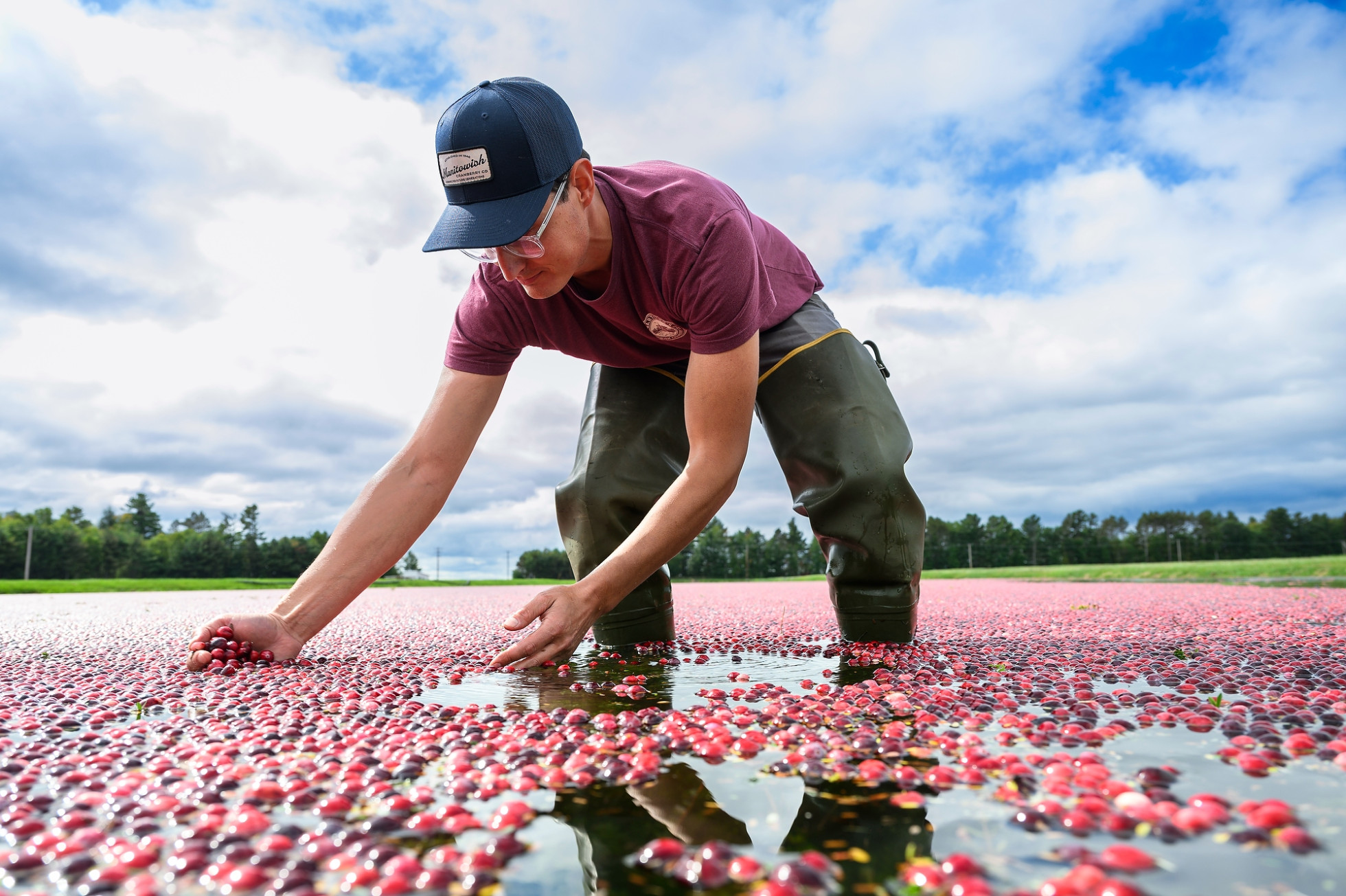
If you closed your eyes — and maybe if David Bartling wasn’t trying to shout over the roar of harvesting machinery — you might guess he was talking about his software business or a chemistry lab. Not the weather on the farm.
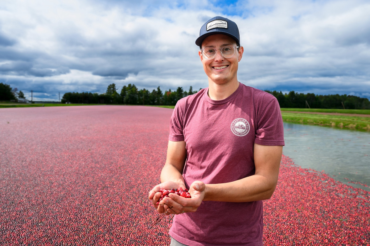
“The more data, the better,” says Bartling, co-owner of Bartling’s Manitowish Cranberry Co. in Vilas County. “I have an engineering background, and an engineer likes data.”
Over the nearly 80 years and three generations the Bartling family has been growing cranberries in Wisconsin’s Northwoods, plenty has changed about the way farmers approach their work. In particular, understanding the growing environment — temperature and moisture, above ground and below, past and present and future — has taken on a decidedly modern edge.
Precise weather data for precision agriculture
“When you dial down and focus on ways to support the farmers in our very diversified agricultural economy in Wisconsin, what they require feels familiar to a scientist,” says Chris Kucharik, professor of plant and agroecosystem sciences in the University of Wisconsin–Madison’s College of Agricultural and Life Sciences. “It’s detailed information, different types of support tools, data-based models to help them guide their decision-making.”
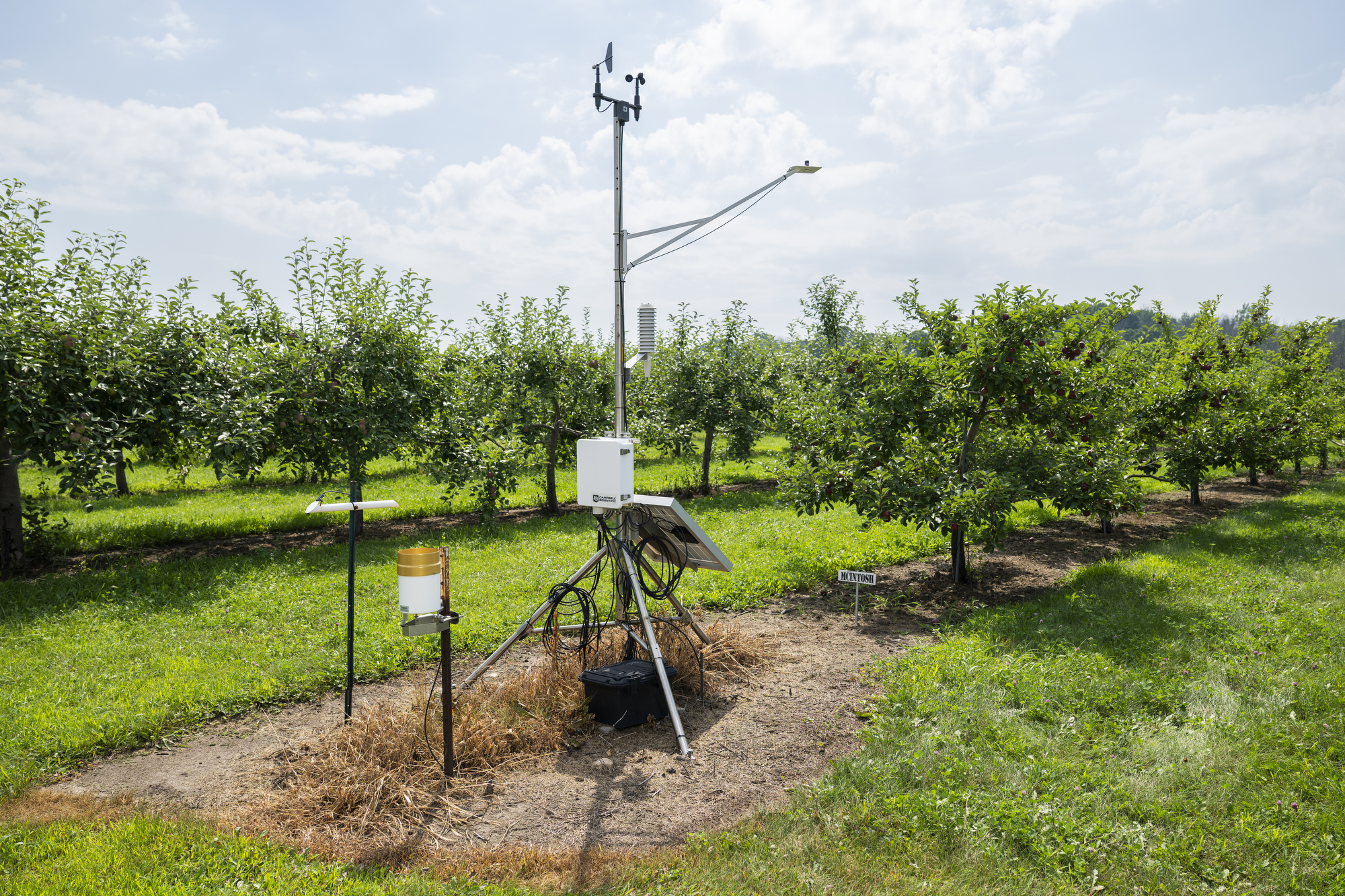
Kucharik is the director of a team of meteorologists, engineers, web developers and technicians building out Wisconet, a statewide network of high-quality weather stations providing valuable, local data to farmers.
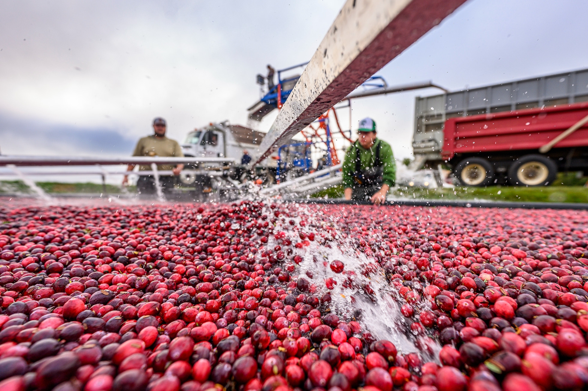
In Bartling’s case, it couldn’t be more local. In 2024, he and Michael O’Brien, a neighbor and general manager of Vilas Cranberry Co., agreed to allow Wisconet to install a station on a shared berm between their farms. Now, research-grade instruments are taking new measurements of air and soil temperature, humidity, precipitation, wind and more every few minutes within yards of their plants.
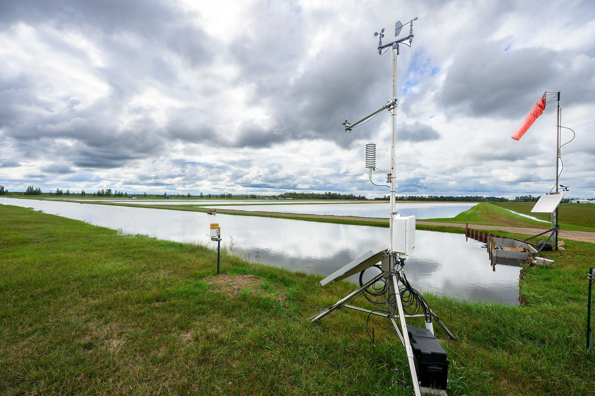
The station delivers near real-time data on precipitation, air and soil temperature, humidity and wind speed.
“When you’re applying fertilizer or treating for pests, to be able to do that according to data coming from right down the road from your own beds, that benefit is awesome,” says Barting, a UW–Madison graduate in biological systems engineering.
“The rain gauge we had for 40 years was probably $5 down at the hardware store. And if I forgot to drive by it and empty it after the last rain … Well, Wisconet is a little more reliable.”
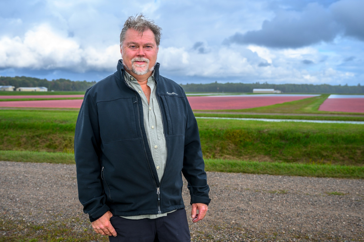
“You’d be surprised how many farmers don’t have access to that kind of information. The equipment and expertise is expensive,” O’Brien says. “To my knowledge, all the growers around here use it. And we can look at surrounding stations to see what’s coming toward us or whether something is starting to move off.”
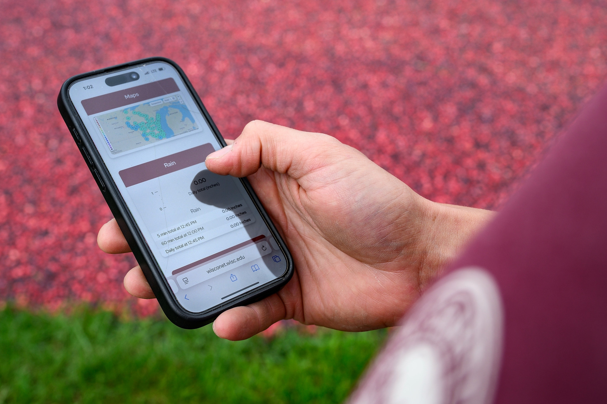
And, because each Wisconet site has a page on the network’s website reporting the latest (and historical) data, Bartling can check on his farm while he’s dropping his daughter at daycare in the morning or making a run to the supply store.
It’s not easy for owners of small farms to invest in data and analysis, according to O’Brien, making Wisconet an important resource even to farms that don’t host a Wisconet station.
“You’d be surprised how many farmers don’t have access to that kind of information. The equipment and expertise is expensive,” he says. “To my knowledge, all the growers around here use it. And we can look at surrounding stations to see what’s coming toward us or whether something is starting to move off.”
Making ‘better decisions’ with on-farm data
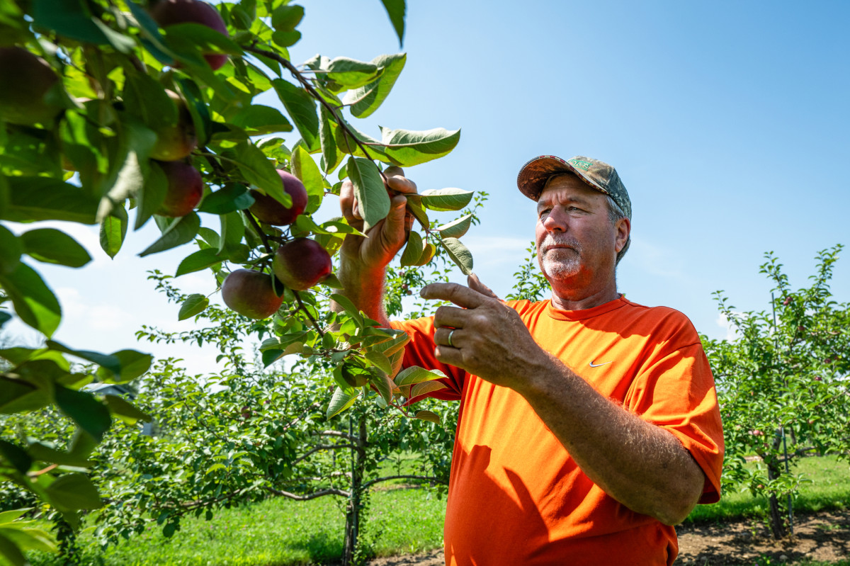
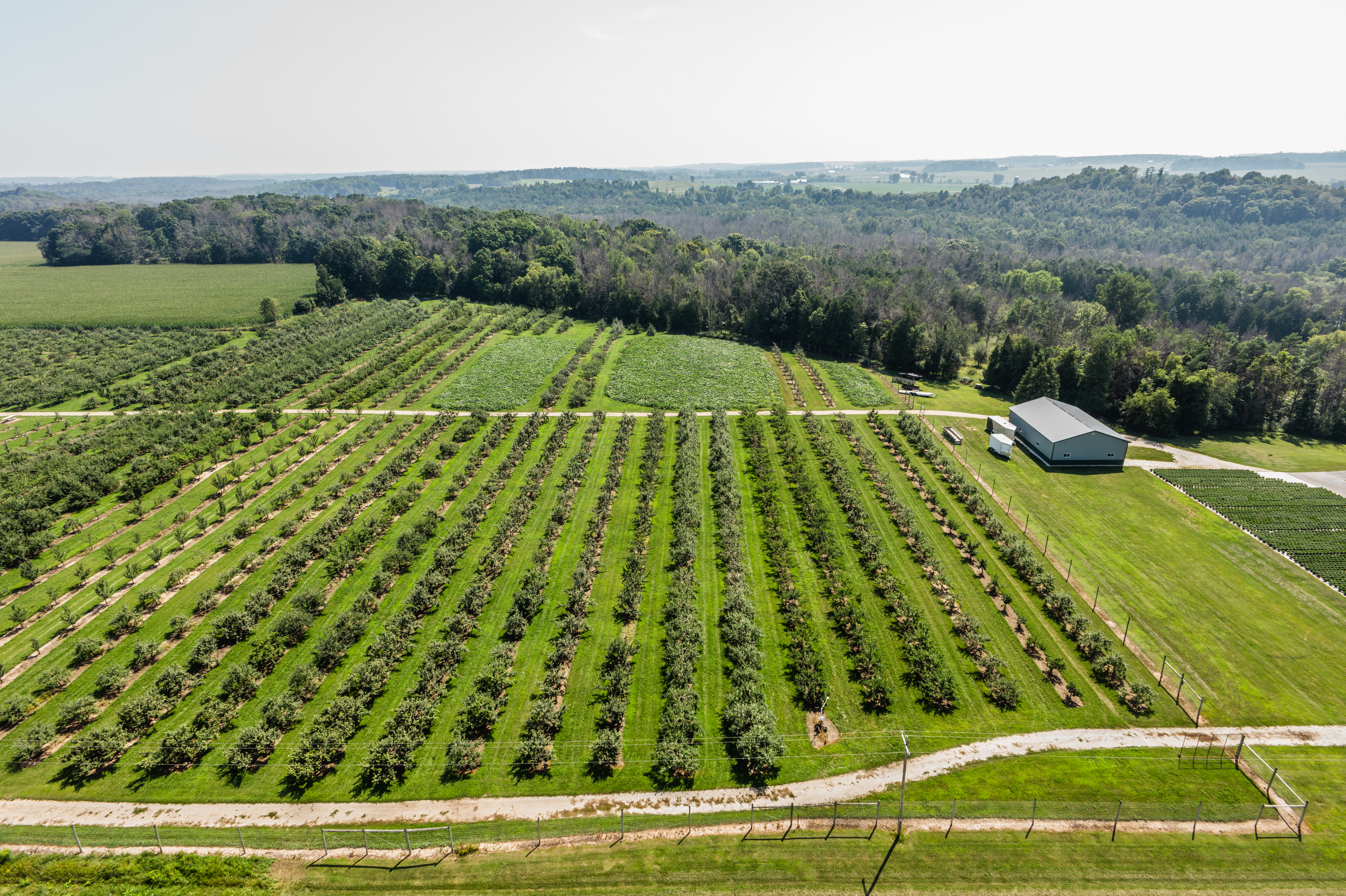
Timely access was important to Bill Roethle, owner of the Hillside Apples farm in Casco, just east of Green Bay. He jumped at the opportunity to relocate a Wisconet station from a nearby farm when its owner decided to retire.
Roethle used to get his farm-relevant weather information by calling a recorded service in Sturgeon Bay, about 20 miles up the Lake Michigan shore.
“Sometimes, they’d have the same message on there for a week or so,” Roethle says. “Now, I can pull out my phone a look at it myself. Better decisions can be made, because it’s right here and it’s up to the minute data.”
A statewide weather network for farms, forests and cities
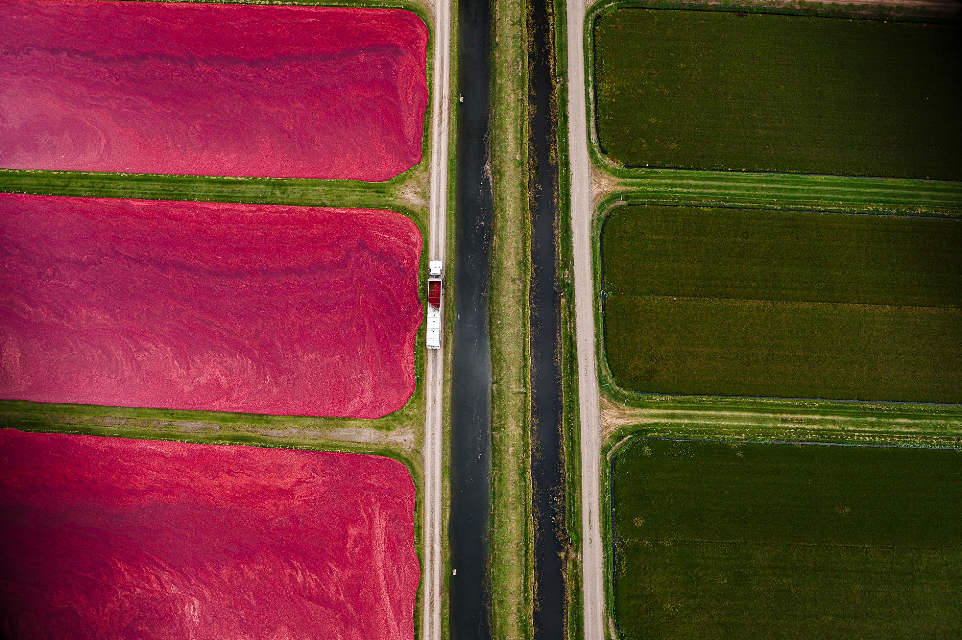
With support from the Wisconsin Alumni Research Foundation, Wisconet has grown since 2023 from 14 stations to nearly 80. The pins marking stations on the state map in Chris Vagasky’s office have quickly accumulated, multiplying Wisconet’s benefits as empty territory disappears.
“They’re in a really diverse range of locations, including farms, forests and built-up areas,” says Vagasky, a meteorologist and Wisconet program manager. “So, the data we gather from these stations can be used at different scales — locally, regionally or as a networked representation of the whole state — in ways that are useful for agriculture, for emergency management and research applications.”

Research Moves Us Forward
Learn more about the impact of UW–Madison’s federally funded research and how you can help protect it.
Wisconet also shares its stations’ data with the National Oceanic and Atmospheric Administration, contributing to services like national severe weather forecasting and drought monitoring.
It’s also available to the public. On Wisconet’s website, anyone can find the station closest to them — or in another corner of the state — to check current conditions or recent trends and even tools that map heat risk and storm severity.
Many other states have weather station networks, called mesonets, referring to observations taken on the mesoscale or across 10s or 100s of kilometers. Wisconet stations go above and beyond for farmers, adding to the typical mesonet station’s array of equipment some extra sensors — like those that track soil moisture at intervals down several feet into the ground.
Funding from the U.S. Department of Agriculture-supported Wisconsin Rural Partnerships Institute has helped Wisconet developers turn the stream of data from the stations into tools specific to different types of crops grown around the state.
“We can translate the stations’ reports into alerts when the conditions are just right for a particular disease to spread through cherry trees or when it’s almost been warm and wet enough for a pest that eats corn roots to emerge,” Kucharik says. “Having specific and timely knowledge about their own area is a real economic advantage for Wisconsin farmers.”


